These 3D street maps are accurate enough to detect individual potholes
And HERE is making them widely available for self-driving cars
One of the biggest bottlenecks on the road to the widespread adoption of self-driving cars is the quality of mapping data that’s currently available.
HERE, a Nokia company, hopes to speed up the process by making its high-definition mapping data available for car companies to use in their self-driving car research.
Currently public road sections from four different countries including the US, France and Germany are available, with the roads of Silicon Valley included amongst the data.
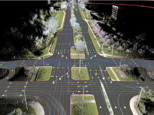
HERE’s HD map data is accurate within ten to 20 centimetres, and is gathered using LiDAR technology which illuminates targets with a laser before analysing the reflected light to record the distance and position.
In this manner, billions of 3D points can be recorded, capturing not only the precise width and lane layouts of a road, but also the slopes, hills and potholes too, in addition to roadside objects like signposts.
Recent UK legislation regarding self-driving vehicles highlights how seriously authorities are taking the safety of road users into account.
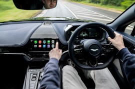
Currently in the UK, self-driving vehicles must have drivers inside them at all times – drivers which have undergone extensive testing on private roads with "skills over and above those of drivers of conventional vehicles".
The vehicles also have to be fitted with a data recording device which records, amongst other things, speed, steering, braking, and even the use of indicators and lights.
The wide availability of self-driving cars with a mapping system as detailed as HERE’s -which ensures that cars avoid obstacles and are positioned as accurately as possible on the road – will be a big step in ensuring full adoption.
We’ve still quite a long way to go before you’ll be automatically chauffeured to Tesco for your weekly shop, but with even Apple rumoured to be working on a driverless car of its own, it’s just a matter of time.
TomTom and Bosch want in on the action too
TomTom and Bosch have also announced a partnership in which they’ll be working together to produce highly detailed maps of their own.
Bosch’s engineering work will define the specifications that TomTom’s maps have to meet, and these maps are already being used on certain public roads on Germany and the US.
The two companies aim to have high-precision maps for every single motorway in Germany by the end of 2015, with plans to extend coverage to the rest of Europe and the US.
The ultimate aim is to have a system in which changes to roads (such as new lane configurations or signs) are picked up by fleets of vehicles equipped with sensors, which then relay the newer information back to a server, which in turn updates the maps in drivers’ cars.
Cream of the crop › These are the best smartwatches in the world
 Esat Dedezade
Contributor
Esat Dedezade
Contributor