Google Maps navigation goes 3D in the biggest update in over a decade
Google Maps gets a visual overhaul with the Gemini-powered Immersive Navigation option.
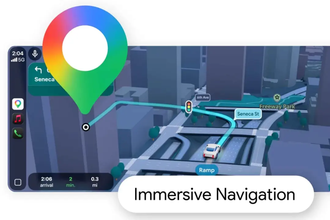
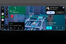
Google has announced a massive Google Maps update, which transforms the navigation experience from a 2D environment into vivid 3D with buildings, overpasses and terrain depicted along the route.
The company says the update to the driving experience is the biggest in over a decade and provides more intuitive guidance alongside the new visuals. That means updates to lanes, crosswalks, stop signs and traffic lights shown in detail along the way.
The Gemini-powered update offers a “spatial understanding” of the route, Google says in a blog post. The models “analyze fresh, real world imagery from Street View and aerial photos to give you an accurate view of things along your route, like landmarks and medians.”
Google is also rolling out what it calls a “broader view of the route”. That will include smart zooms and transparent buildings. That’ll help users get a better look at an upcoming turn or lane change. That’ll potentially make things a little safer too.
Furthermore Google plans to give users more information about other suggested routes, so you’ll get proper context about whether the longer trip provides less traffic, or whether the faster one will cost you a few quid at a toll. You’ll still get real time update on traffic, construction and accidents crowdsourced by drivers. And, for the last leg of the journey, users will get a look at the buildings entrance and suggestions for nearby parking.
Google is also adding a feature called Ask Maps, which brings the conversational experience of Gemini to Google Maps. Now you can ask for things like, “My phone is dying — where can I charge it without having to wait in a long line for coffee?” or “Is there a public tennis court with lights on that I can play at tonight?”
Immersive Navigation and Ask Maps begins rolling out in the US initially, on iPhone and Android.
 Chris Smith